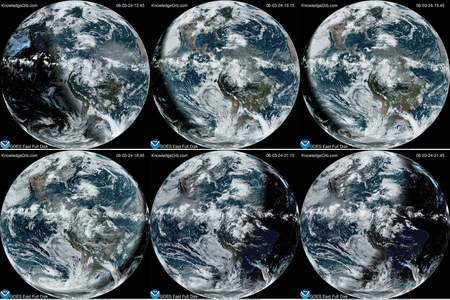
This animation of NOAA’s GOES-East satellite data shows the development and movement of the weather system that spawned tornadoes affecting the southern and eastern U.S. states on April 27-29, 2014. Image Credit: NASA/NOAA GOES Project

This animation of NOAA’s GOES-East satellite data shows the development and movement of the weather system that spawned tornadoes affecting the southern and eastern U.S. states on April 27-29, 2014. Image Credit: NASA/NOAA GOES Project
This post is credited to the source listed within the post.


| Cookie | Duration | Description |
|---|---|---|
| cookielawinfo-checkbox-analytics | 11 months | This cookie is set by GDPR Cookie Consent plugin. The cookie is used to store the user consent for the cookies in the category "Analytics". |
| cookielawinfo-checkbox-functional | 11 months | The cookie is set by GDPR cookie consent to record the user consent for the cookies in the category "Functional". |
| cookielawinfo-checkbox-necessary | 11 months | This cookie is set by GDPR Cookie Consent plugin. The cookies is used to store the user consent for the cookies in the category "Necessary". |
| cookielawinfo-checkbox-others | 11 months | This cookie is set by GDPR Cookie Consent plugin. The cookie is used to store the user consent for the cookies in the category "Other. |
| cookielawinfo-checkbox-performance | 11 months | This cookie is set by GDPR Cookie Consent plugin. The cookie is used to store the user consent for the cookies in the category "Performance". |
| viewed_cookie_policy | 11 months | The cookie is set by the GDPR Cookie Consent plugin and is used to store whether or not user has consented to the use of cookies. It does not store any personal data. |